


Tom Voting District, Benton County, Missouri
About
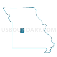
Outline

Summary
| Unique Area Identifier | 607110 |
| Name | Tom Voting District |
| County | Benton County |
| State | Missouri |
| Area (square miles) | 55.47 |
| Land Area (square miles) | 36.14 |
| Water Area (square miles) | 19.33 |
| % of Land Area | 65.15 |
| % of Water Area | 34.85 |
| Latitude of the Internal Point | 38.25213200 |
| Longtitude of the Internal Point | -93.45130500 |
Maps


Graphs
Select a template below for downloading or customizing gragh for Tom Voting District, Benton County, Missouri


Neighbors
Neighoring Voting District (by Name) Neighboring Voting District on the Map
- Alexander Voting District, Benton County, MO
- Fristoe Voting District, Benton County, MO
- Jackson Voting District, St. Clair County, MO
- Leesville Voting District, Henry County, MO
- North Lindsey Voting District, Benton County, MO
- Osage Voting District, Henry County, MO
- South Lindsey Voting District, Benton County, MO
Top 10 Neighboring County Subdivision (by Population) Neighboring County Subdivision on the Map
- South Lindsey township, Benton County, MO (2,822)
- Fristoe township, Benton County, MO (2,450)
- Tom township, Benton County, MO (2,232)
- North Lindsey township, Benton County, MO (1,765)
- Leesville township, Henry County, MO (1,079)
- Osage township, Henry County, MO (779)
- Jackson township, St. Clair County, MO (617)
- Alexander township, Benton County, MO (527)
Top 10 Neighboring Place (by Population) Neighboring Place on the Map
Top 10 Neighboring Elementary School District (by Population) Neighboring Elementary School District on the Map
Top 10 Neighboring Unified School District (by Population) Neighboring Unified School District on the Map
- Warsaw R-IX School District, MO (10,830)
- Lincoln R-II School District, MO (3,945)
- Lakeland R-III School District, MO (3,211)
Top 10 Neighboring State Legislative District Lower Chamber (by Population) Neighboring State Legislative District Lower Chamber on the Map
- State House District 116, MO (38,212)
- State House District 119, MO (36,209)
- State House District 120, MO (35,276)
Top 10 Neighboring State Legislative District Upper Chamber (by Population) Neighboring State Legislative District Upper Chamber on the Map
Top 10 Neighboring 111th Congressional District (by Population) Neighboring 111th Congressional District on the Map
Top 10 Neighboring Census Tract (by Population) Neighboring Census Tract on the Map
- Census Tract 4603, Benton County, MO (4,378)
- Census Tract 4608, Benton County, MO (3,911)
- Census Tract 9502, Henry County, MO (3,809)
- Census Tract 4803, St. Clair County, MO (3,182)
- Census Tract 9504, Henry County, MO (3,027)
- Census Tract 4607, Benton County, MO (2,821)